
Cougar Mountain Regional Wildland Park
Part One: Hiking Trails Of The West Side

It's not always necessary to travel long distances in order to get away from the big city and into the wilderness. Located in the Issaquah Alps, Cougar Mountain Regional Wildland Park is a great example of this. Less than a 1/2 hour drive from Seattle you’re able to find yourself in a 3,100 acre forest that provides a recreation area consisting of 50+ trails, multiple creeks and waterfalls, a decent elevation gain, city views, and peacefulness.
We visited this wonderful place and spent much more time there than we thought was possible. We only made it through about a third of the park. This is part one of our story exploring Cougar Mountain.
“A Great Big Green and Quiet Place”
History
Cougar Mountain has a long history of coal mining dating back to the 1860s. It has also served as a Cold War NIKE missile site in the 1950s and ‘60s. In 1983, to protect the 1,000 — 1,595 foot elevated mountain, the park was established. It is now a part of the King County Parks and Recreation Division.


Many names of creeks, trails, peaks, and wetlands were invented by Harvey Manning, an author of popular hiking and climbing guides who lived on the mountain. He was also an advocate for preserving and maintaining trails. Due to his efforts, Cougar Mountain is off-limits to bikes. Leashed dogs are permitted throughout the park while horses are only allowed on designated trails.


Starting Out
As mentioned above, the park is large. We spent 5 hours visiting and hiked 10 miles worth of trail. Parking in the lot on the west side of the mountain, off of Newcastle Golf Club Rd./Lakemount Blvd SE, provided us the opportunity to explore a good portion of the central to west area of the park.
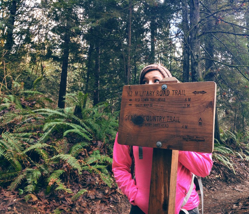
Before starting out, we picked up a helpful map of all the trails and points of interest at the park info board. We highly recommend grabbing one of these, or at the very least download one before leaving home, as the various trails will have you confused quickly after making a few turns. We referred to the map at every trail intersection.


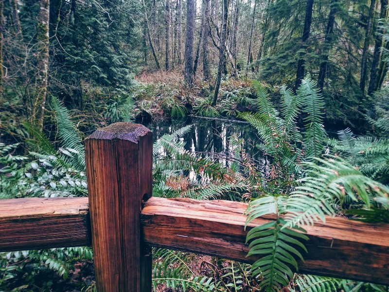
There was one goal in mind when visiting, and that was to explore some of the many cave holes which were located on the official park map. We were let down as these holes were all full of water and off limits, nothing more than ponds.
The main trails we took were Cave Hole Trail, Sky Country Trail, Nike Horse Trail, Indian Trail, De Leo Wall Trail, Marshall’s Hill Trail, Far Country Trail, and Wildside Trail. Besides these, we traveled briefly on other named trails in order to connect to the ones we needed. Again, the map was very useful.
Exploring the Woods
The trails within the park boundaries are fairly well maintained. We encountered no downed trees or other barriers while hiking. It rained heavily the morning prior to our arrival and there were numerous muddy spots. There were also several areas where small rivulets crossed over the paths, none were impassable.


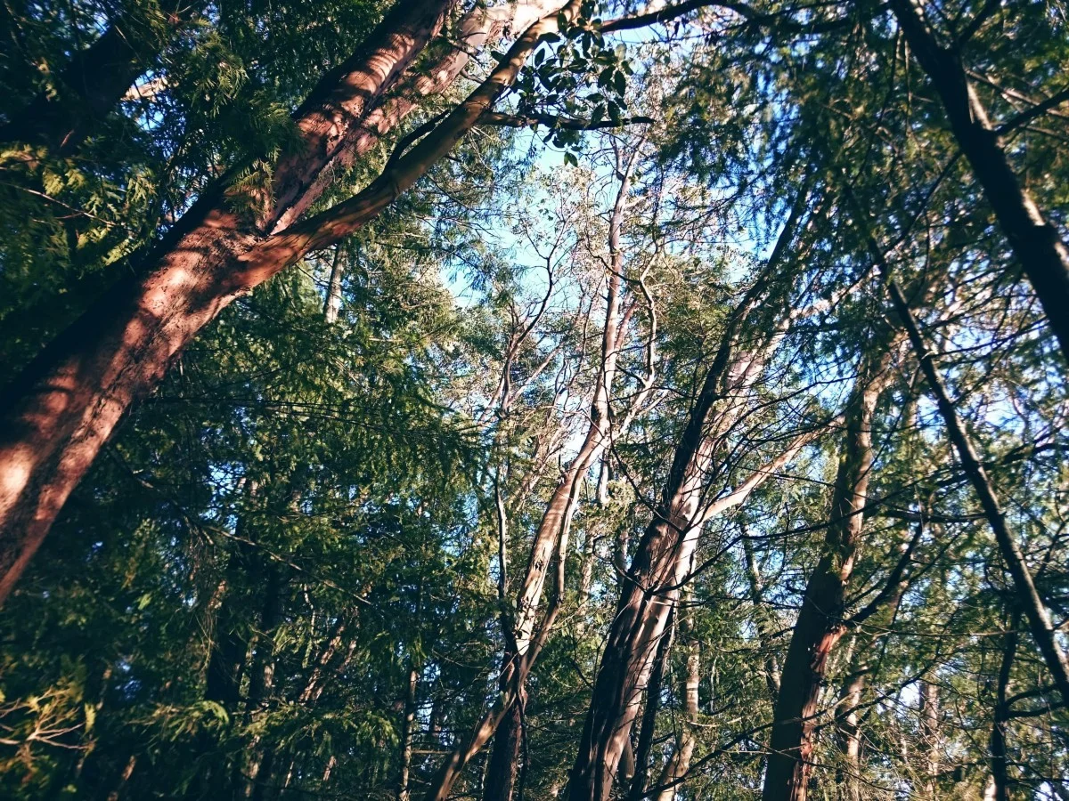
The sound of trickling or rushing water could be heard on nearly all parts of our trek. We were fortunate that the rain had ceased by the time we arrived. The clouds cleared a bit and we had glorious moments of bright sunshine breaking through the trees. The temperature was right around 50, with a breeze that came and went. The breeze was far more prevalent on higher portions of the trails.
The wind in the bare limbs, overhead, brought to mind images of primitive jousting contests. The clashing of tightly entwined branches was often the only sound competing with the sounds of running water. On other occasions, the whining and groaning of large swaying conifers sounded like the forest was singing to us.


There were numerous footbridges, and wooden walkways. We found the remnants of an old dam, the sealed entrance to an old coalmine, coal cart and other leftovers from mining days. While there were signs indicating possible encounters with bears and cougars, we only saw a few birds.


We crossed paths with perhaps a dozen other people, several trail runners and others with dogs. We expected we see a greater number of people, but perhaps the recent downpour changed their plans. For the bulk of the hike, we were graced with the solitude that comes with being alone with nature.


We plan on going back in the future to explore the remaining area. Luckily there are three additional parking lots — north, northeast, and south areas of the park — so we won’t be hiking through any parts we previously had (not that there’s anything bad about that).


Hopefully the hazy fog won’t be as bad next time. We’ll update this post with a link to part two once we finish that story. We’re not sure when we’ll make it back to this park as there are so many other places that still need to be explored!
Hey, we appreciate your readership! If you're in the market for new gear and would be willing to make your purchase through our Amazon link, we might get a small commission out of it. No additional cost to you and maybe a little something for us!
Thank you for your support!
Our Photos


Wander More, Worry Less!
Have you been to Cougar Mountain? Did you see a cougar? Let us know by leaving a comment below.
Helpful Information
Coordinates: 47°31′15″N 122°05′29″W
Hours: 8am — Dusk
Elevation range: 1,000–1,595'
Amount of trails: 50+
Total miles: 38
Fee/Pass: No fee or pass required
Follow along on our wanderings around the Pacific Northwest.
The only thing better would be being there yourself!
Subscribe to Our Newsletter