
Little Si
Hiking The Little Brother Of Mt. Si

Standing in front of its bigger brother, Mt. Si, Little Si is aptly named. Don’t let that fool you for it being an easy hike. Reaching the summit is going to take some work as it’s a 1,300 foot gain in elevation.
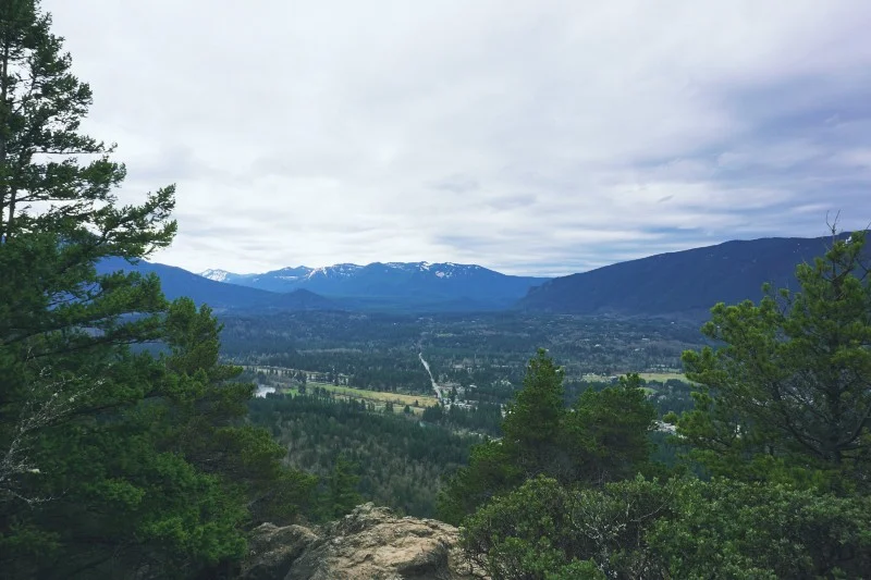
Upon reaching the summit the views are pretty good looking out towards the town of North Bend and the Issaquah Alps off in the distance. The views behind you, of big brother Mt. Si, are excellent.
The 4.7 mile round trip took us roughly 3 hours to complete. About 1.5 hours going up (we stopped for photos a lot), spending 30 minutes at the top, and an hour down.
“Somewhere between the bottom of the climb and the summit is the answer to the mystery why we climb.”
Getting There
We read plenty about this being a very popular hike. All reports mentioned the parking lot being full if you don’t arrive early. So we planned to get up early and be there by 9 A.M. Oh course, that never works out as intended.
We arrived at the parking lot a little after 11 A.M. on a clear Friday morning — full.
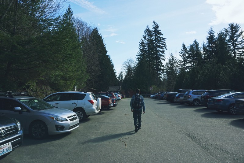


It’s a small lot, but luckily there was additional parking right down the road. That lot was nearly empty. We parked and walked/hiked a little side trail that connects the two lots.
A quick restroom break and we began our hike at 11:20 A.M. with the temperature in the low 60s. A perfect day for hiking!
The Hike
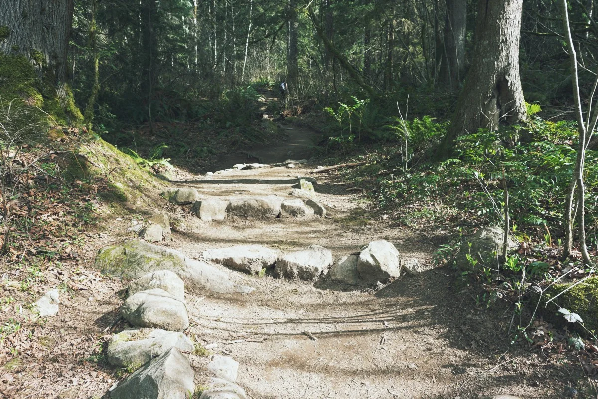
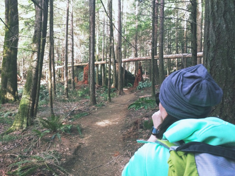
The beginning of this well maintained trail had us ascending right off the bat for the first 3/4 mile. Before getting too far, we noticed a side trail off to the left about 0.2 miles in.
It provided a natural viewing plateau of the area we’d eventually see up top. We took a few photos, drank some water, and then pressed on.


We continued upwards through rocky, heavily rooted switchbacks. It was dry during our visit but we can see how this area may be slippery when wet. Along this first portion we had a bit of a hard time telling which way the trail actually went, due to the amount of rock. We quickly got back on track.
Eventually the path leveled out and turned into an all dirt path, minus the rocks. On our right we came across a sign for Boulder Garden Loop, a 1.5 mile loop trail that also connects to the Old Big Mt. Si trail. Pressing onward and we found ourselves at the other end of the loop fairly quickly.


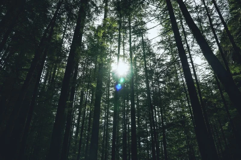
After passing over a stream the trail began to bend to the right. From here on to the final stretch it began to once again gain in elevation. Not as steep as the first portion. It was a pretty easy walk in the woods.
We came across a bench with other hikers in the surrounding area taking a break. We decided this was a good time for a break ourselves. There are some larger boulders in this area that we explored. The tumble of boulders made for interesting crevices and sheltered areas that begged exploring. During the moments when there were no others around, the quiet of the forest and surrounding giant rocks was impactful.


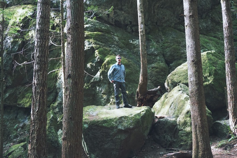
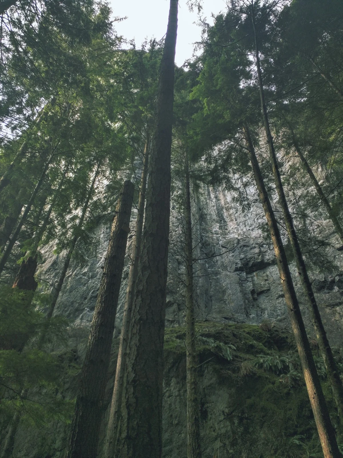
After awhile we were on the back side of Little Si. Looking up we saw the large rock wall. This area had a marked trail heading off towards the wall for rock climbers. We saw 3–4 climbers with their gear while scoping out the wall on our way back.

We arrived at a switchback and that’s where the real climb began. It was only about a 1/2 mile from here. Along this portion the trail became rocky again in spots and there were a few areas of the path not clearly marked. Nothing to worry about, we found our way back on path quickly again.


The Summit
Once we were nearer the top it began to level out a little. Cliffs of the rock wall were off to the left with great views of Mt. Si in the back. Be careful here. Heading up the rock just a bit further brought us to the true summit.
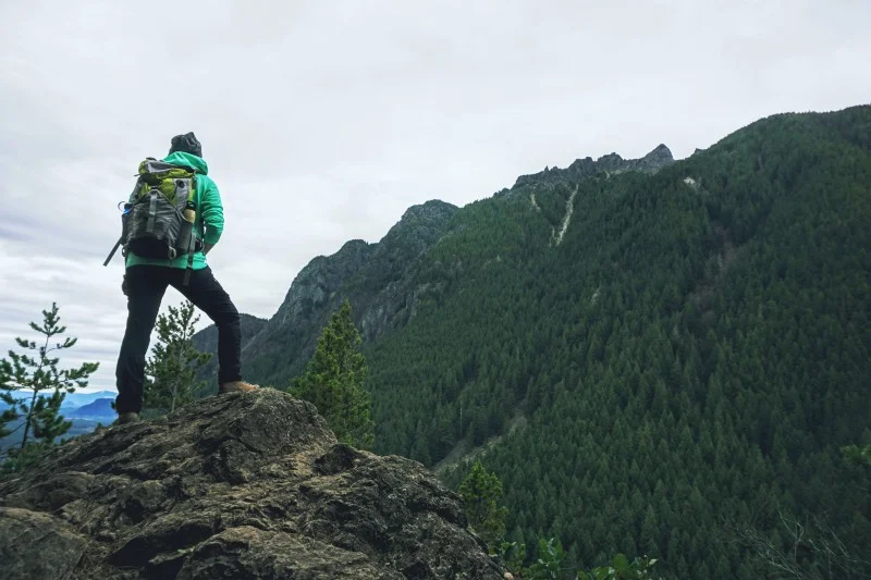


Although trees are obscuring a full 360 degree view, we were able to see quite a bit. Below and in front of us were parts of the town North Bend. Off in the distance Rattlesnake Ledge was clearly visible.


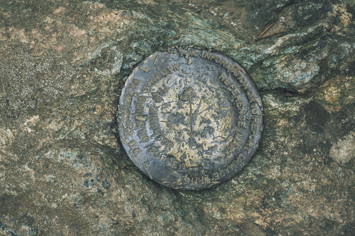
We located two survey markers atop the rock.

We took a few photos then sat down for lunch. The day was perfect. Clear skies, great temperature, and not much wind. There were about 10 others up here, spread out. As we lunched, clouds began to move in and the temperature began to cool. We looked around a bit more for views to photograph then started back down.


Coming Back and Final Thoughts
The way back was easy and quick. Though this trail is rocky and has a plenitude of upraised tree roots, gravity is your friend on the descent. This is a well traveled trail. We encountered numerous hikers, runners, people with dogs and children on the ways up and down. Despite the human population we saw some chipmunks and squirrels and lots of birds.
Upon returning the main parking lot was now nearly empty and it had just begun to rain. Perfect timing!


Hey, we appreciate your readership! If you're in the market for new gear and would be willing to make your purchase through our Amazon link, we might get a small commission out of it. No additional cost to you and maybe a little something for us!
Thank you for your support!
Helpful Information
Trailhead coordinates: 47.486759, -121.753482
Elevation gain: 1,300'
Highest point: 1,550'
Trail length, round trip: 4.7 miles
Trail difficulty: Moderate
Fee/Pass required: Discover Pass
Wildlife seen: 1 chipmunk, 1 squirrel, a bunch of birds
Follow along on our wanderings around the Pacific Northwest.
The only thing better would be being there yourself!
Subscribe to Our Newsletter