Want to take a step back in time? A time when humans were as small as insects in comparison to the surrounding forest? This is the place for you. No time machine required.
Read More
Want to take a step back in time? A time when humans were as small as insects in comparison to the surrounding forest? This is the place for you. No time machine required.
Read MoreThis easy hike along the Pacific Crest Trail leads to the beautiful Sheep Lake. It's a pretty short trek, just under an hour for us even though we stopped for lots of photos along the way. It's easy to see why the area is so popular. The water is clear and looks inviting; the peaks, meadows, and tress make for a beautiful backdrop; and the peacefulness throughout the area makes it hard to leave. With this being an easy to reach trailhead, as well as an easy hike, everyone should make it out here at least once. The rewards for the lack of difficulty are hard to find elsewhere.
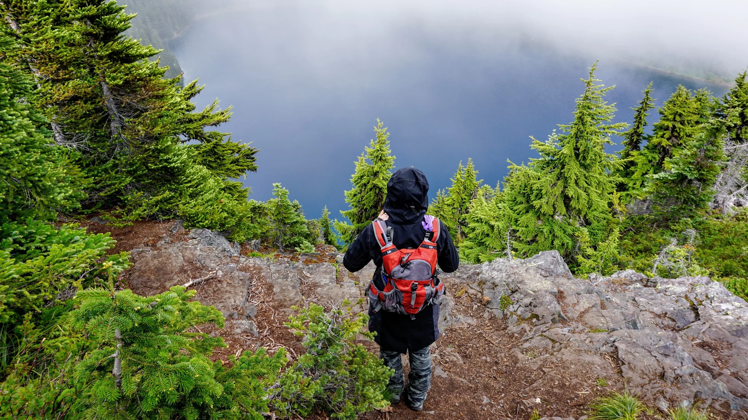
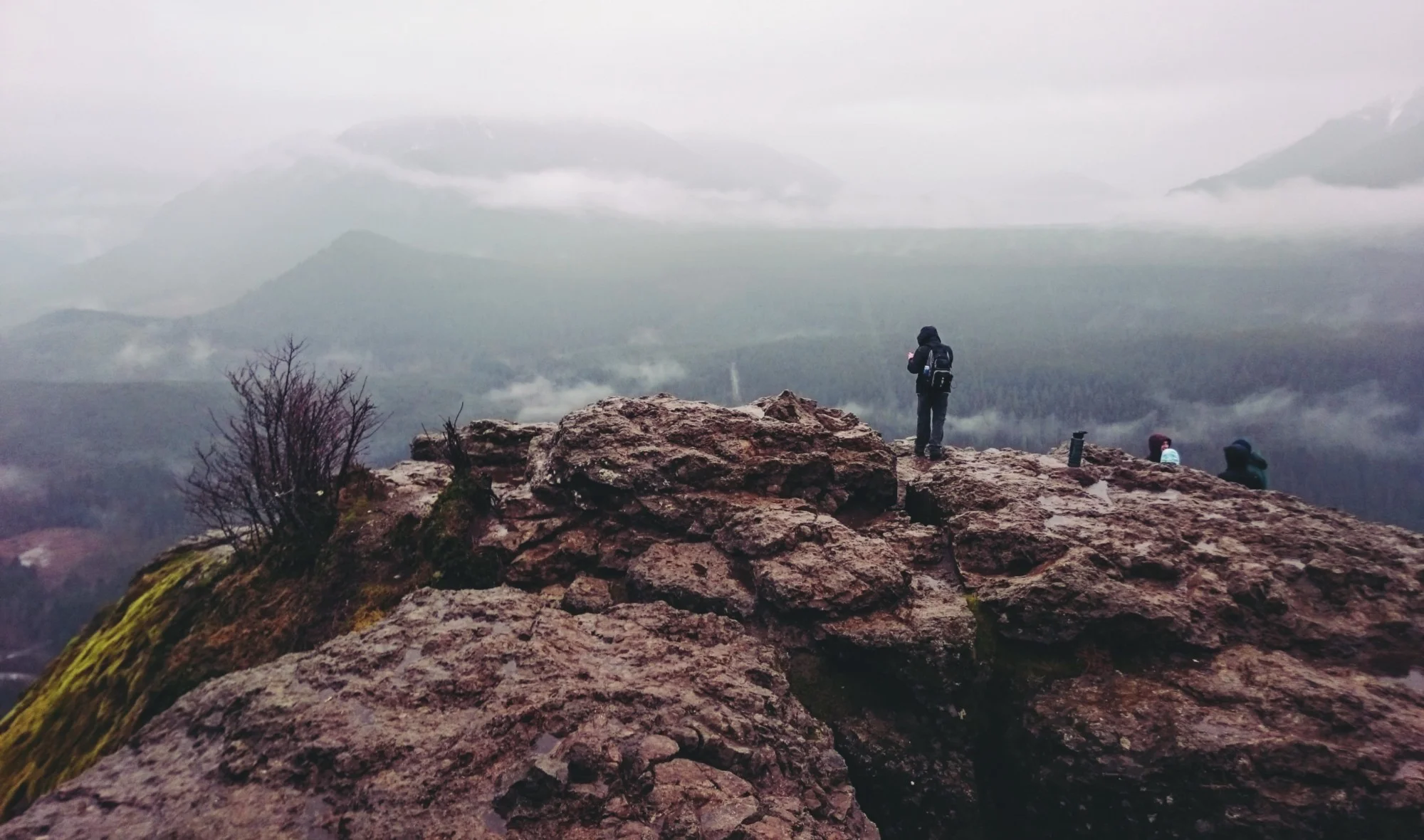
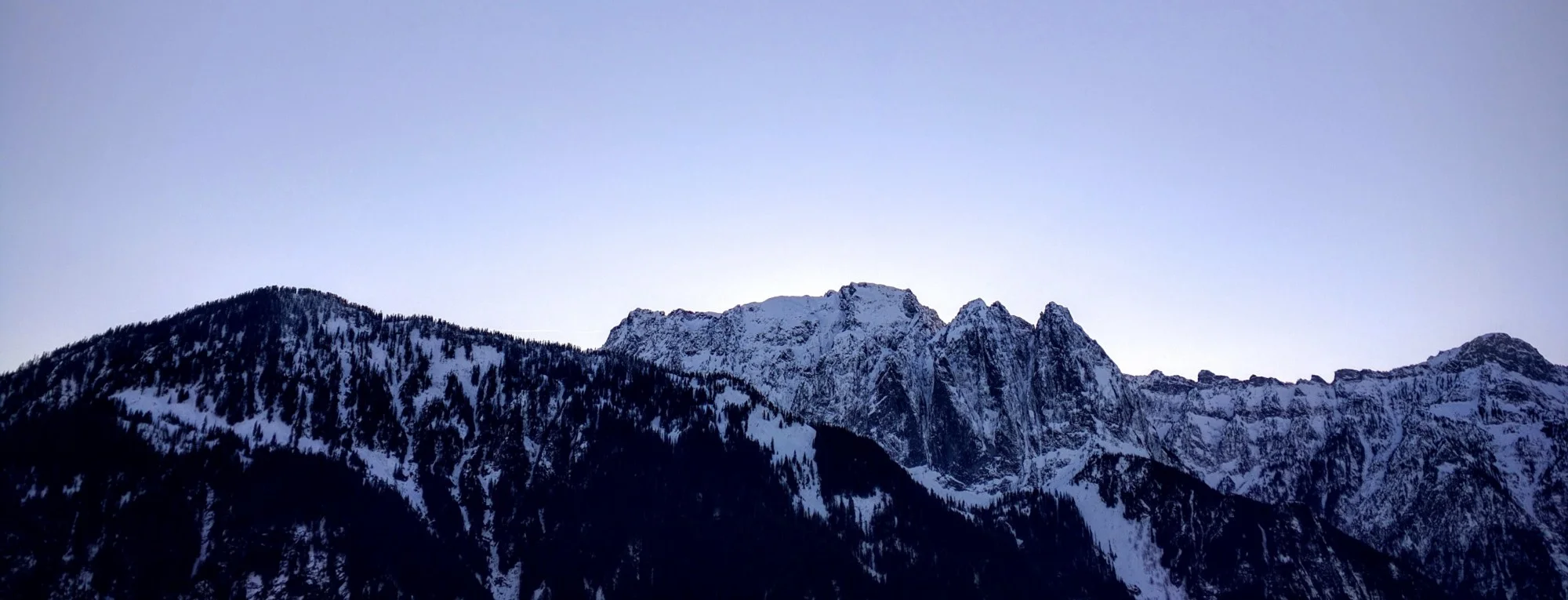
Read MoreTo the west of Mt. Rainier lies Glacier View, a 5,450' peak which normally provides wonderful views of some of Rainier's magnificent glaciers. During our hike the weather was cloudy with fog, which prevented us from seeing much of anything in the distance. Upon reaching our destination, however, we were more than satisfied. It appeared as though we were on a ship, sailing through a sky of mist.
Read MoreWhen is summer going to arrive in the Pacific Northwest? That's a question we keep asking ourselves. Earlier this week we were once again met with rain, clouds, and chilly temperatures during our hike. We were hoping for views of Mt. Rainier's glaciers but the majority of our journey through Glacier View Wilderness left us with seeing no more than the tops of nearby trees. This certainly didn't stop us, and shouldn't stop you, from trekking to the beautiful Lake Christine.
Read MoreIn the Clearwater Wilderness, at 5,400 feet high, lies a pristine, calm, and dark blue alpine lake. Reaching this magical area in the early summer months will have you hiking your way through forest, switchbacks, and trail junctions, as well as passing other lakes, fields of avalanche and glacier lilies, and if you're lucky, wildlife. During our visit we were accompanied by clouds hanging right around the treeline. However, we've seen photos of a nearly-cloudless day there and the views are amazing. Nevertheless, our trip was a great one and the clouds that day simply give us another excuse to revisit soon.
Read MoreA 13,042' long lava tube lies beneath the Gifford Pinchot National Forest, south of Mt. Saint Helens. It was created by a rare eruption that sent fluid basaltic lava flowing down the southern flank of the volcano for months, if not a year. The top of this lava flow hardened, forming the ground today that rests atop the cave, while the lava was free to remain flowing under it. This is the third longest lava tube in North America, and the longest in the country, which was created during an eruption roughly 2,000 years ago.
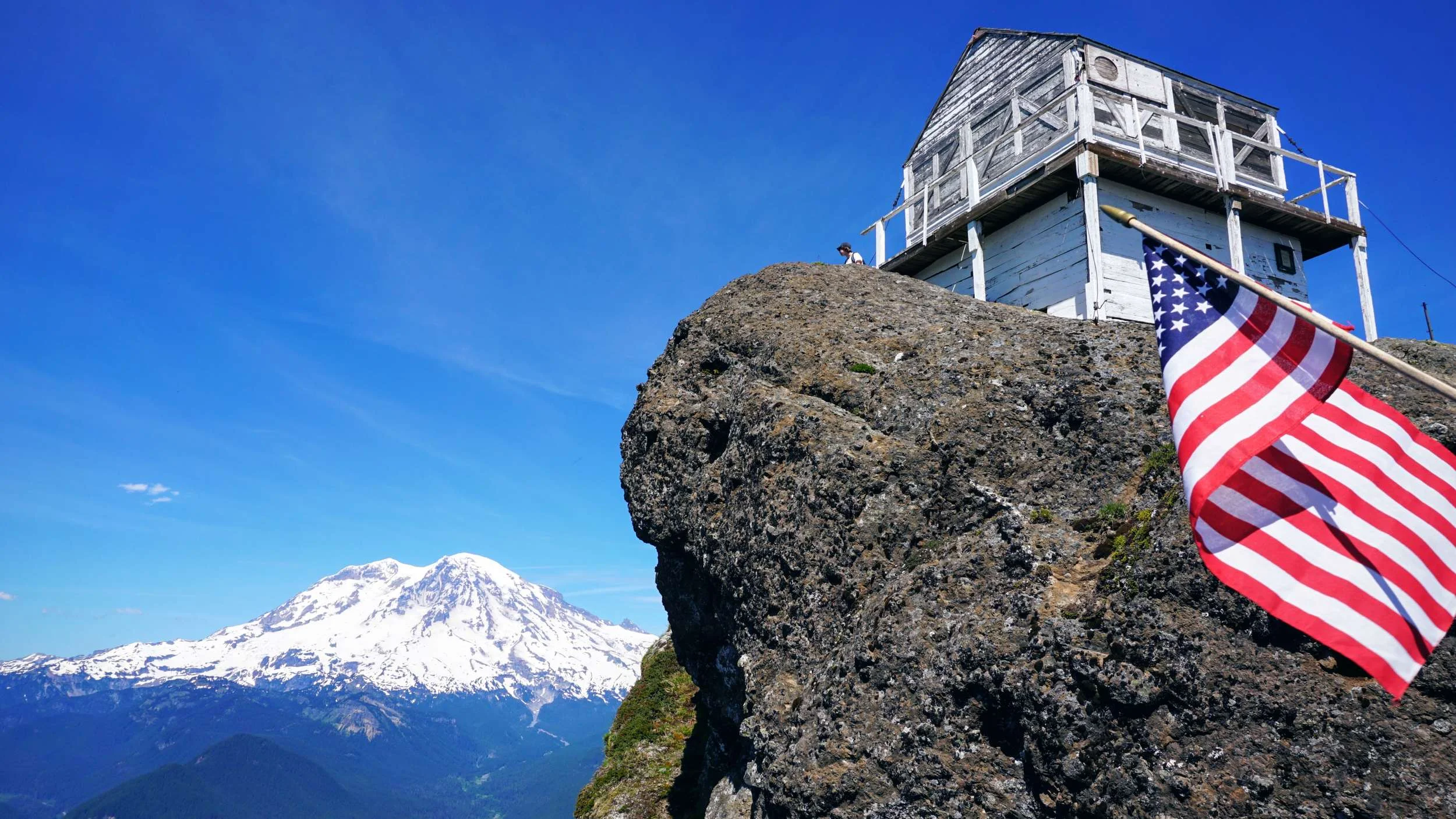
Read MoreHigh Rock is a 5,685' prominent peak located on Sawtooth Ridge which provides beautiful, unobstructed, 360 degree views as far as the eye can see. Located on the rock is an old fire lookout, one of only three remaining in the Gifford Pinchot National Forest, which was built in 1929. The north face of the rock has a 600' sheer drop, without any protection from falling. Explore this area, but do so carefully.
Read MoreNative Americans fished and hunted for centuries in the Cama Beach area before logging took over in the mid-1800s. After that, cottages and fishing resorts were built and Muriel and Lee Risk operated one such resort between 1934 and 1989. Around 1990 Washington State Parks began to acquire land through family donations and purchased other parts of it. Today the park offers visitors a restful and relaxing getaway. It also includes learning the history and culture of native people from the area. There's a Center for Wooden Boats where you may learn about boat building. The park includes numerous cabins for overnight stays along the waterfront with a park store nearby that offers groceries, snacks, supplies, and much more.
Read MoreThe third-highest peak in Capitol State Forest is known as Rock Candy Mountain. One could easily assume that the mountain is very rocky from the name, but that was not the case for most of our hike. Hiking to the 2,356' summit had us stepping over streams, wandering under a thick forest, and crossing a few logging roads. The views on a clear day are spectacular and allowed us to see as far away as Mt. Saint Helens.
Read MoreThis past week we headed north again. We've seen many people share photos of Deception Pass and we also noticed the signs for it on the drive to Oyster Dome from the previous week. We decided it was time to check it out. We wanted to stay the night but we felt that it was still a bit cold for a tent so we started looking for cabins. The only available cabin at Deception Pass State Park was out on Ben Ure Island and required a kayak or canoe to reach it, which we don't have. So we looked around nearby and found one available at Bay View State Park.
Read MoreOverlooking the San Juan Islands, with views all the way to the Olympics, Oyster Dome provides an opportunity for some gorgeous scenery. The location is in the second-growth Blanchard Forest, on Chuckanut Mountain. This area was extensively logged in the mid-1800s until the land was deeded to the state in 1925. Today, the Washington State Department of Natural Resources provides diverse recreation opportunities here and in the surrounding areas.
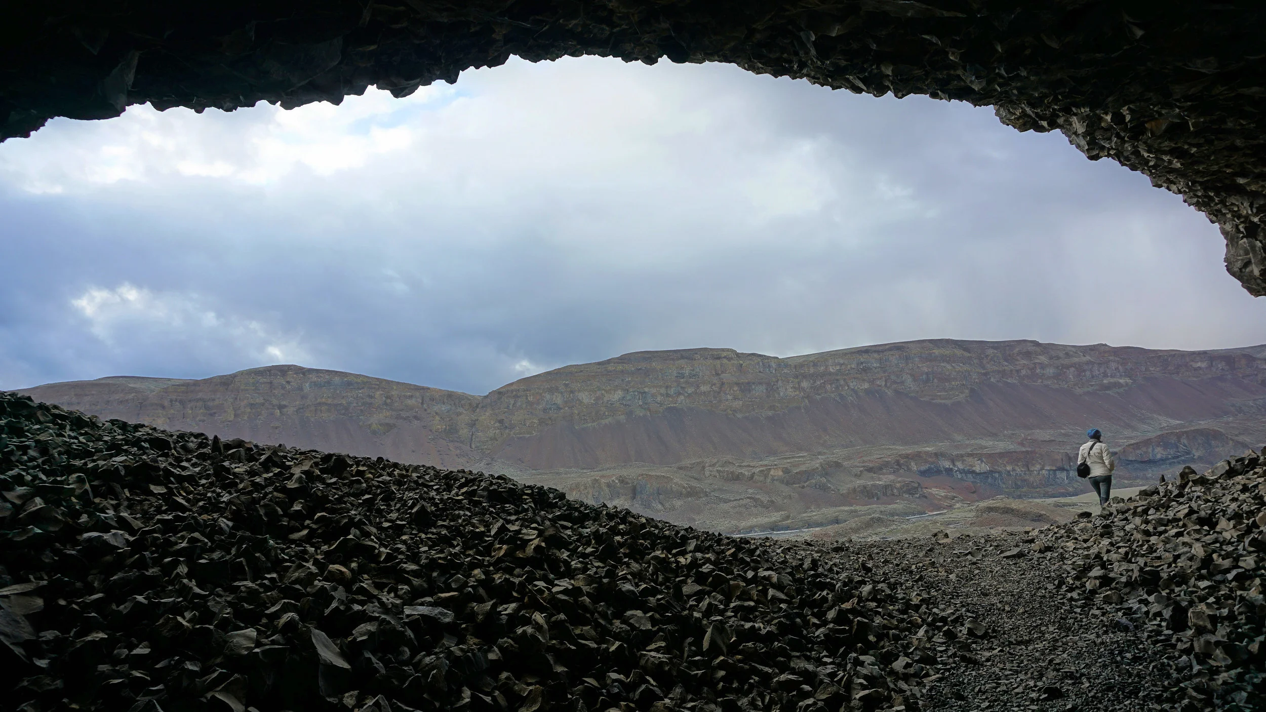
Read MoreCreated by the Missoula Floods during the last Ice Age some 15,000 and 13,000 years ago, this area is a geologists best friend. Ridges, plateaus, rivers, lakes, coulees, and caves are some of the sites to be seen and explored here. 5,000 years ago Native Americans used this area to collect plants, fish, and hunt. The caves were used as a temporary shelter by them. Today it’s used for explorers and hikers like us.
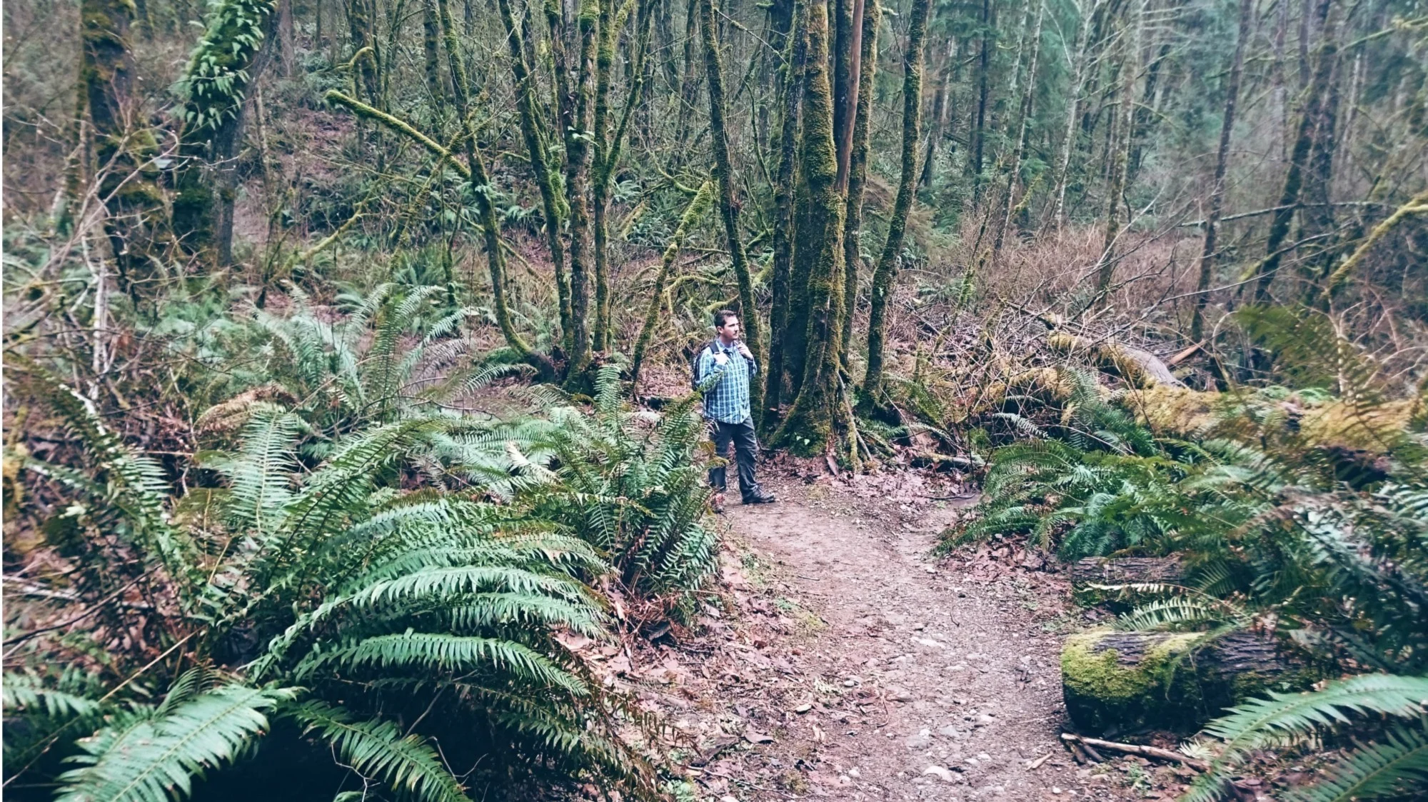
Read MoreStanding in front of its bigger brother, Mt. Si, Little Si is aptly named. Don’t let that fool you for it being an easy hike. Reaching the summit is going to take some work as it’s a 1,300 foot gain in elevation.
Upon reaching the summit the views are pretty good looking out towards the town of North Bend and the Issaquah Alps off in the distance. The views behind you, of big brother Mt. Si, are excellent.
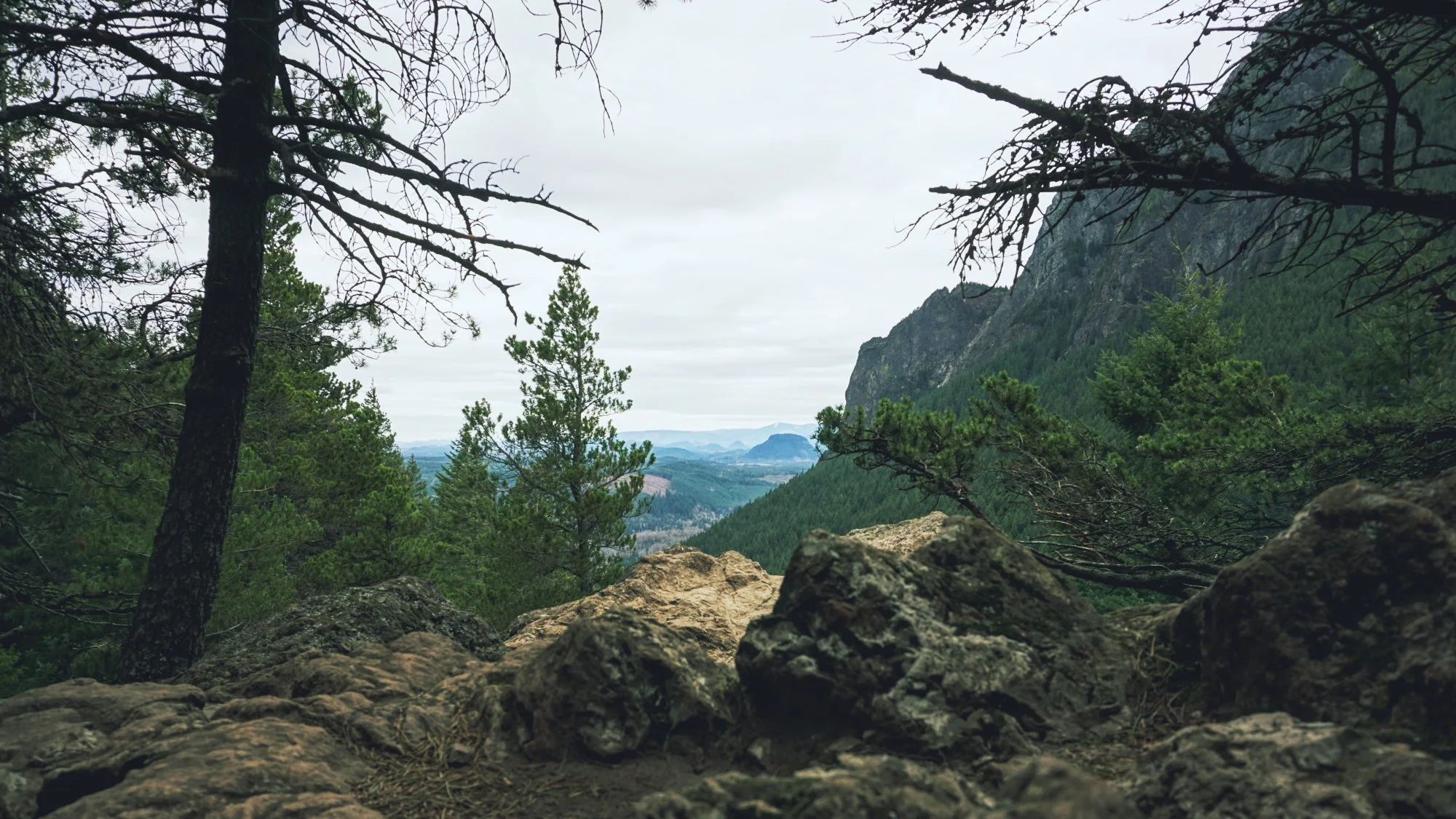
Read MoreAs you park at Rattlesnake Lake you immediately notice mountains to the south, east and northwest of you. You’re tucked into a nice little area right here with beauty surrounding you in all directions — mountains, forest, a lake. Rattlesnake Mountain is located to the northwest, across from the lake. The mountain has a prominence of 2,520 feet. Rattlesnake Ledge, your hike for the day, is somewhere around half that.
Read MoreIt's not always necessary to travel long distances in order to get away from the big city and into the wilderness. Located in the Issaquah Alps, Cougar Mountain Regional Wildland Park is a great example of this. Less than a 1/2 hour drive from Seattle you’re able to find yourself in a 3,100 acre forest that provides a recreation area consisting of 50+ trails, multiple creeks and waterfalls, a decent elevation gain, city views, and peacefulness.
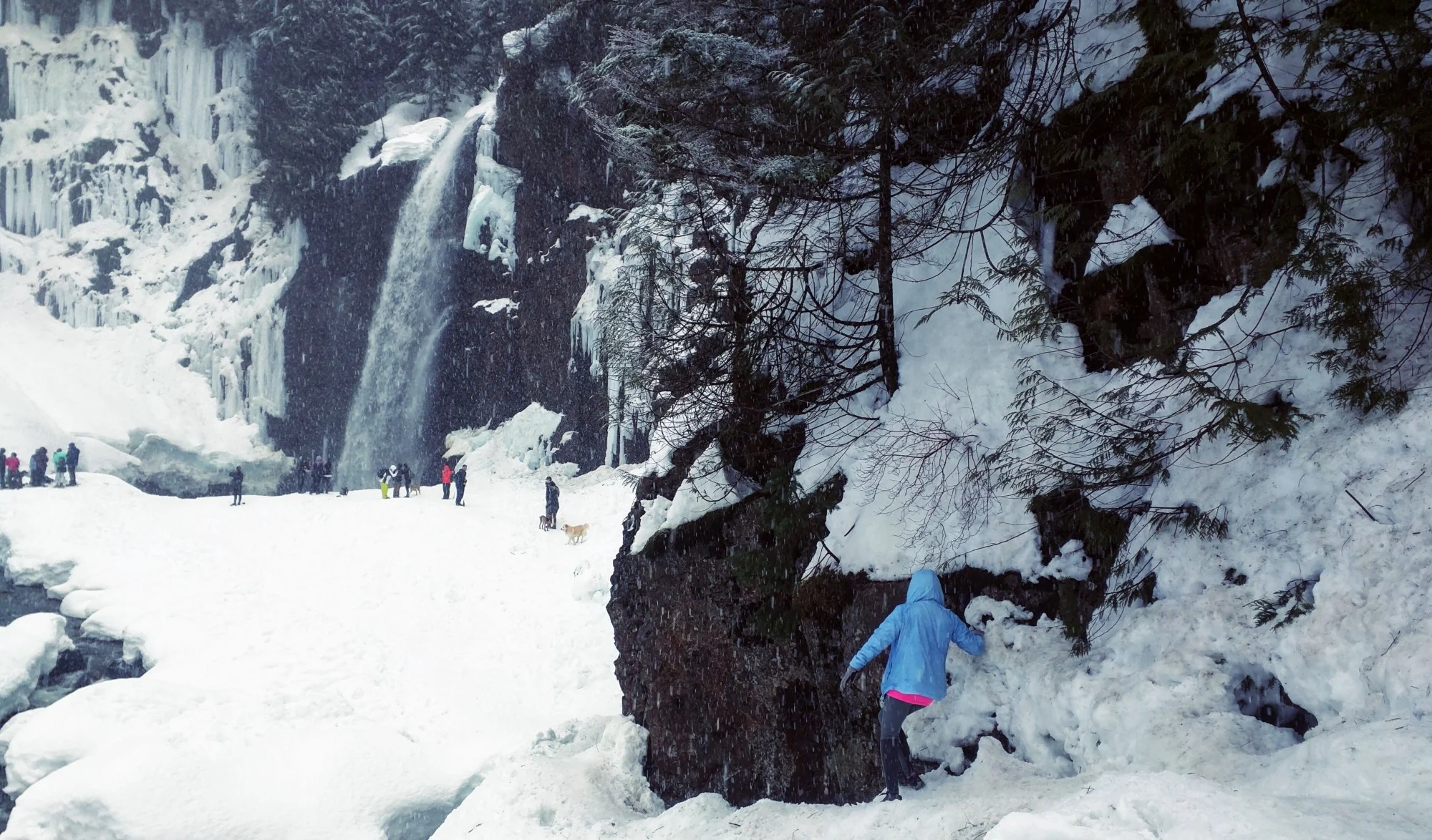
Read MoreThis weekend we headed to Mt. Baker-Snoqualmie National Forest to visit Franklin Falls. Located along I-90, just before the slopes of Snoqualmie Pass, it’s about an hour’s drive from Seattle. This is one of the most visited waterfalls in the state. It’s easy to understand why once you see it.
Read MoreOn the western edge of the Central Cascade mountain range is Heybrook Lookout Trail #1070. It traverses through a second-growth forest that leads to a seven flight observation deck overlooking many nearby peaks, a close town, and more. The 900-foot elevation gain, just over a mile in length, had us catching our breath more than a few times on the way up. The views from the top on a sunny and clear day made the hike well worth it.
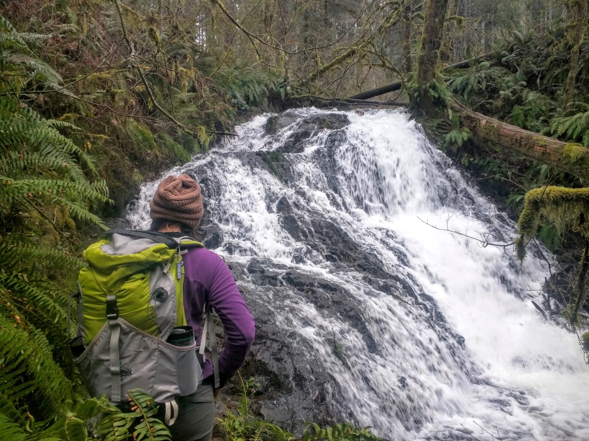
Read MoreWe arrived at the campground around 12:15. The day was rain-free with peek-a-boo sunshine. The temperature was mid 40’s and little to no breeze. We started up Mima Falls Trail East.
Read More